Key facts
- It’s the Inca stone path that reaches Machu Picchu on foot through the Sun Gate (Intipunku), within the Historic Sanctuary of Machu Picchu.
- The classic route starts at km 82 (Piscacucho), about 2 h from Cusco, and covers about 40 km in 4 days; the short one starts at km 104 and is hiked in one day.
- The highest point is Warmiwañusqa Pass, at 4,215 m; the Short Inca Trail stays below 2,720 m.
- You can only do it with a licensed agency: the ticket is issued in your name, has a daily quota (500 users on the long routes and 250 on the km 104 route) and includes the visit to the citadel.
- It closes for all of February for maintenance; for May to August, it’s best to book four to six months ahead.
Inca Trail availability
Daily permit availability for the Inca Trail. February is closed for maintenance.
- Inca Trail 4 days: Oct 31 (54 seats), Nov 1 (176 seats), Nov 3 (181 seats), Nov 4 (151 seats)
- Inca Trail 2 days: Oct 31 (58 seats), Nov 1 (70 seats), Nov 2 (92 seats), Nov 3 (107 seats)
Reference seats from the official sale, updated every 30 minutes. They can change within minutes: always confirm on the official site before you buy. Inca Trail permits can only be booked through licensed tour operators.
The Inca Trail, known in Spanish as the Camino Inca, is the stone path the Incas built to Machu Picchu. The classic route covers about 40 km in four days from km 82 of the railroad, crosses a 4,215 m pass, goes by a dozen archaeological sites and enters the citadel on foot through the Sun Gate. There’s also a short 2-day version from km 104. Both require a permit issued in your name, with a daily quota, and can only be done with a licensed tour agency.
In this guide you’ll find where the Inca Trail to Machu Picchu is, how permits work, the day-by-day route with its elevations, the difficulty, the best time to go and what to bring. If you’re still deciding between this and another trek, our Machu Picchu treks compared guide puts every route side by side.
The Inca Trail at a glance
| Fact | Classic Inca Trail | Short Inca Trail |
|---|---|---|
| Duration | 4 days and 3 nights camping | 2 days: 1 of hiking and 1 for the visit, with a night in a hotel |
| Start | Km 82 (Piscacucho), about 2 h from Cusco | Km 104 (Chachabamba), by train |
| Hiking distance | About 40 km | About 12 km, in 6 to 7 hours |
| Maximum elevation | 4,215 m (Warmiwañusqa Pass) | 2,720 m (Intipunku) |
| Difficulty | Challenging, mainly because of the stairs | Moderate |
| Daily quota | 500 users, counting guides and porters | 250 users |
| Arrival at Machu Picchu | On foot through the Sun Gate, before dawn on day four | On foot through the Sun Gate, in the afternoon |
| Closure | All of February, for maintenance | All of February |
Where is the Inca Trail?
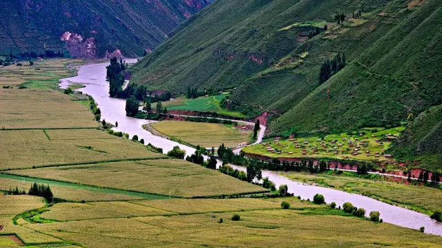
The Inca Trail lies within the Historic Sanctuary of Machu Picchu, in Urubamba Province, Cusco Region. It follows the bank of the Urubamba River (also called the Vilcanota in this area) and climbs through the mountains that separate the valley from the citadel. It starts at points along the railroad that are named for their distance in kilometers from Cusco: km 82 for the classic route and km 104 for the short one.
You reach km 82, at Piscacucho, by road from Cusco in about two hours, passing through the Sacred Valley and Ollantaytambo. You reach km 104 by train, with a special stop. In both cases the agency arranges the transfer.
The Inca Trail and the Qhapaq Ñan
Many people search for the “Inca Trail” with Argentina, Chile or Bolivia in mind, and they’re partly right. The Incas built a road network that connected the entire Tawantinsuyu, their empire: the Qhapaq Ñan, or Andean Road System. In 2014 UNESCO inscribed it as a World Heritage Site, with sections in six countries: Argentina, Bolivia, Chile, Colombia, Ecuador and Peru. The Inca Trail to Machu Picchu is a branch of that network, the most famous one and the only one that ends at a citadel like this.
Permits: how to book the Inca Trail
The Inca Trail is the only route to Machu Picchu with a daily quota. It’s managed by Peru’s Ministry of Culture, through its Cusco regional office (DDC Cusco), and by SERNANP, the national protected areas service, and you can’t hike it independently.
- Only with a licensed agency: travel agencies registered with the DDC Cusco buy the tickets for their clients. Since September 2026, they do so exclusively through the official Tu Boleto platform, with full, immediate payment.
- It’s issued in your name: the ticket carries your name and ID number. You need a valid ID to buy it and to get in, and the agency also registers the guides and porters.
- It includes the citadel: the Inca Trail ticket includes the visit to Machu Picchu within the route’s time frame. If you want to go in on a different day, you’ll need a separate Machu Picchu ticket.
- Quota: 500 users a day on the long routes and 250 on the km 104 route. That figure includes guides, cooks and porters, so there are far fewer spots for hikers.
- No refunds: an unused ticket loses its validity. It can only be rescheduled for duly documented force majeure or unforeseeable events.
Important: check that your name and passport number are spelled correctly before the agency pays. The ticket is issued in your name and the regulations make no provision for transferring it to someone else; the only thing that can be changed, up to 24 hours before entry, is the guide.
How far in advance to book
To travel from May to August, it’s best to book four to six months ahead, because dry-season permits sell out fast. For April, September and October, two or three months are usually enough, and in the rainy season there’s more leeway. February isn’t an option: the Inca Trail Network closes for the entire month for maintenance, although Machu Picchu stays open.
How to choose an agency
This guide doesn’t recommend companies. When comparing, ask for a written list of what’s included: transfers, the return train, the bus down from the citadel, the number of porters, meals, tent, sleeping bag and whether there’s a personal porter. Check that the agency is registered with the DDC Cusco, and ask for your e-ticket in your name once it’s issued.
The 4-day Inca Trail: the route day by day
This is the full route, the one most people picture when they search for “Inca Trail.” The names and elevations of the sites come from information published by Andina, Peru’s state news agency; the exact campsites depend on the ones assigned to each group.
Day 1: km 82 to Wayllabamba
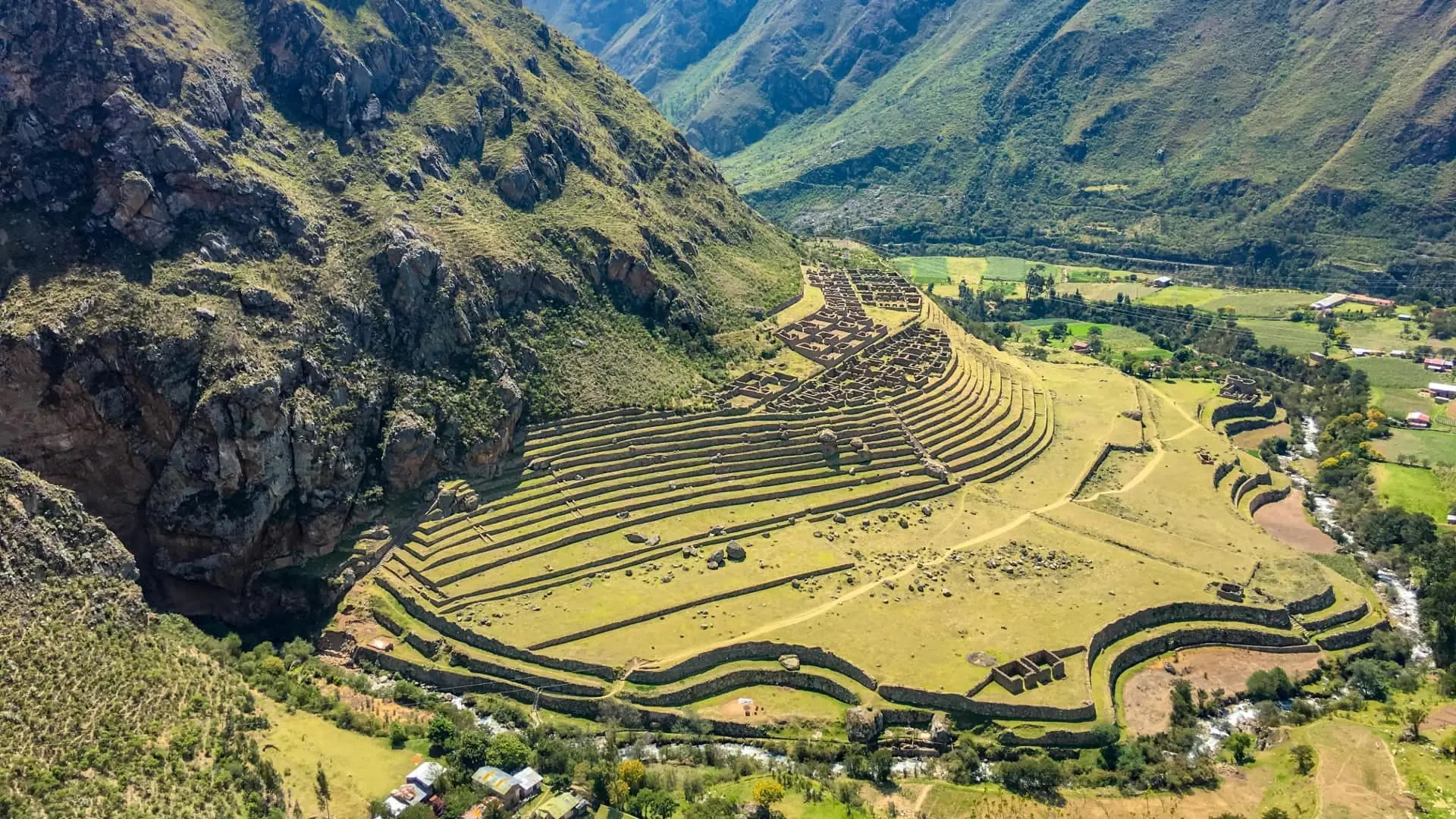
You go through the checkpoint at Piscacucho, cross the river and walk an easy stretch alongside the Urubamba. The first major site is Llactapata, at about 2,840 m, where the Cusichaca and Urubamba rivers meet. The day ends in the Wayllabamba area, a valley with farming families and the first rest stop on the route. It’s a day to find your pace.
Day 2: Warmiwañusqa Pass
This is the hardest day. You climb about 9 km, over four or five hours, to Warmiwañusqa Pass, “Dead Woman’s Pass,” at 4,215 m: the highest point on the Inca Trail. At the top the wind blows and the temperature hovers around 5 to 7 °C. Then you descend on stone steps to the Pacaymayo campsite.
Day 3: the day of Inca sites
This is the most beautiful day and, for many, the longest. You pass Runkurakay, a semicircular structure at about 3,760 m; Sayacmarca, at about 3,625 m, with a staircase of almost a hundred steps; and Phuyupatamarca, at about 3,670 m, overlooking the Urubamba River. Then you descend through cloud forest and the terraces of Intipata to Wiñay Wayna, at about 2,650 m, one of the most beautiful complexes on the route. Its name is linked to an orchid that grows abundantly in the area.
Day 4: the Sun Gate and Machu Picchu
You set out before sunrise and hike to Intipunku, the Sun Gate, at 2,720 m and almost a kilometer from the citadel. From there you see Machu Picchu for the first time. You head down to the citadel, take the guided tour of the site and then catch the bus to Aguas Calientes and the train back.
Inca Trail map: the route profile
This table sums up the classic route from start to finish, with the approximate elevation of each point. Use it as a pocket map to understand where the trail climbs and where it drops.
4-day Inca Trail: the altitude, stage by stage
- Day 1
- Llactapata (Patallaqta)2,840 m
- Day 2
- Warmiwañusqa Passthe highest point of the trail4,215 m
- Day 3
- Runkurakay3,760 m
- Sayacmarca3,625 m
- Phuyupatamarca3,670 m
- Intipata2,840 m
- Wiñay Wayna2,650 m
- Day 4
- Intipunku (Sun Gate)2,720 m
- Machu Picchu2,430 m
| Point | Approximate elevation | What it is |
|---|---|---|
| Km 82 (Piscacucho) | Valley floor | Entry checkpoint and start |
| Llactapata (Patallaqta) | 2,840 m | First major Inca site |
| Wayllabamba | Inhabited valley | First rest stop |
| Warmiwañusqa | 4,215 m | Highest point on the Inca Trail |
| Pacaymayo | Valley below the pass | Second night’s campsite |
| Runkurakay | 3,760 m | Semicircular structure, possibly a tambo (way station) |
| Sayacmarca | 3,625 m | Complex on steep terrain |
| Phuyupatamarca | 3,670 m | Plazas, a sacred rock and fountains |
| Intipata | 2,840 m | Terraces |
| Wiñay Wayna | 2,650 m | Terraces and fountains; last night nearby |
| Intipunku | 2,720 m | Sun Gate, first view of Machu Picchu |
The 2-day Inca Trail
The Short Inca Trail starts at km 104 (Chachabamba), which you reach by train. You hike about 12 km in 6 to 7 hours: you climb to Wiñay Wayna, continue along the Inca path to the Sun Gate and arrive in the afternoon. You sleep in a hotel in Aguas Calientes and take the guided tour of Machu Picchu the next day.
- It suits you if: you’re short on days, don’t want to camp or would rather not go above 2,720 m.
- Keep in mind: it’s also issued in your name, it also closes in February and its quota is half that of the long routes.
How many days do you need for the Inca Trail?
The trek itself takes four days on the classic route and two on the short one. Add at least two days beforehand in Cusco or the Sacred Valley to acclimatize, and one buffer day afterward in case the train or the weather causes problems. In practice, the Classic Inca Trail takes up a week of your trip. Our Cusco itinerary shows how to fit it in.
Inca Trail difficulty
The difficulty lies less in the distance than in the stairs. There are thousands of uneven stone steps, going both up and down, and the second day packs in the biggest elevation gain. The altitude does the rest: you’ll sleep and hike above 3,000 m for much of the trek.
- Fitness: you don’t need to be an athlete, but you do need to be able to walk for several hours straight. Train on hills and stairs in the weeks beforehand.
- Knees: the long descents are more tiring than the climbs. Trekking poles help on the trail, although they’re not allowed into the citadel.
- Altitude: acclimatize before you start and tell your guide if you have symptoms. The essentials are in our guide to altitude sickness in Cusco.
This is general information, not medical advice. See your doctor before your trip if you have heart or respiratory problems, or if you’re pregnant.
Camping on the Inca Trail
On the classic route you sleep three nights at official campsites along the trail; there are no hotels. The agency pitches the tents, cooks and carries the gear. Porters carry the tents, the kitchen and the food, and with many agencies you can hire a personal porter for up to 7 kg of your belongings. You hike with a daypack.
The nights are cold, especially the second one, after the pass. A good sleeping bag makes all the difference; if you don’t have one, agencies usually rent them.
Best time to hike the Inca Trail
The dry season, from May to September, has the clearest days and the coldest nights. It’s also when permits sell out the most. April and October are good shoulder months. From November to March there’s more rain, the trail gets slippery and clouds can block the view from Intipunku. In February it’s closed. Check Cusco weather by month before setting your dates.
Tip: if your dates are fixed and there are no permits left, don’t force the Inca Trail. The Salkantay, Lares and the Inca Jungle have no permit limits, and you can walk the last stretch of the Inca Trail at the citadel on route 1-C to Intipunku. The options are in Machu Picchu circuits.
What to bring on the Inca Trail
- ID: the passport or ID your ticket was issued with. You’ll be asked for it at the entry checkpoint.
- Footwear: broken-in mid-height hiking boots.
- Layers: thermal clothing, a fleece and a waterproof jacket. In a single day you go from intense cold to humid heat.
- Water and sun protection: a reusable bottle, sunscreen, a cap and sunglasses.
- Insect repellent: essential on the lower section, near Wiñay Wayna.
- Headlamp: for the campsite and the predawn start on the last day.
- Cash: for snacks, tips and expenses in Aguas Calientes.
The full list is in our Cusco packing list. Remember that your large backpack won’t get through the citadel’s entrance check: leave it with your porter or at the luggage storage.
Summary: is the Inca Trail right for you?
- Yes, the 4-day classic: if you want the full historical experience, are booking months ahead and are in good shape.
- Yes, the 2-day short trail: if you’re short on time or don’t want to camp.
- Better to choose another route: if you’re traveling in February, deciding at the last minute or struggle with stairs. Look at the Salkantay trek or the Lares trek.
If you’re weighing the Inca Trail against the train, every way to get there is in how to get to Machu Picchu from Cusco.
Frequently asked questions
Where is the Inca Trail located?
In the Historic Sanctuary of Machu Picchu, in Urubamba Province (Cusco). The classic route starts at km 82 of the railroad, at Piscacucho, about two hours by road from Cusco.
How many days is the Inca Trail?
The classic route takes 4 days and 3 nights camping; the short one takes 2 days, one hiking and one for the visit. Add at least two days beforehand to acclimatize in Cusco.
Can you hike the Inca Trail without a tour company?
No. Tickets are bought by agencies registered with the DDC Cusco on the official platform, in each hiker’s name, and you always hike with a guide.
How far in advance do you need to book the Inca Trail?
For May to August, four to six months ahead. In other months, two or three are usually enough. There are no permits in February because the trail closes.
How hard is the Inca Trail hike?
The classic route is challenging: on the second day you climb to 4,215 m and there are thousands of stone steps. The short one is moderate and stays below 2,720 m.
Does the Inca Trail permit include Machu Picchu entry?
Yes. The Inca Trail Network ticket includes the visit to the citadel within the route’s time frame; to enter on a different day you need a separate ticket.
Where do you sleep on the 4-day Inca Trail?
At campsites along the trail, usually around Wayllabamba, at Pacaymayo and near Wiñay Wayna. The agency brings the tents, kitchen and food.
Is the Inca Trail in Argentina?
The Qhapaq Ñan, the Inca road network, ran through Argentina, Bolivia, Chile, Colombia, Ecuador and Peru. The Inca Trail to Machu Picchu is its best-known branch, and it’s in Cusco, Peru.
Official sources
- Tu Boleto (Peru’s Ministry of Culture): official ticket sales tuboleto.cultura.pe

How we put this guide together
Written by Paul Pumalloclla · 17 years in tourism
- Official sources Prices, opening hours and rules checked against Peru’s Ministry of Culture, SERNANP, PromPerú and the train and bus operators.
- Sources cited Every guide links to the sources we used at the end.
- Always up to date When a rule changes, we update the guide and its date.
We’re not a travel agency: we don’t sell tours or take bookings. If a link belongs to a commercial partner, we label it next to the link, and that never changes the facts or the recommendations.
Guide history
- Published
- Last reviewed
Spotted something out of date?
Let us know and we’ll check it against the official source.
Report a change