Key facts
- Machu Picchu is a 15th-century Inca llaqta, or city, a royal estate of the Inca ruler Pachacútec, in use from about 1420 to 1530.
- It lies in the district of Machupicchu, Urubamba province, Cusco region, on the eastern slope of the Andes.
- The Inca city sits at 2,430 m (7,972 ft) above sea level, almost 1,000 meters lower than Cusco.
- There is no road from Cusco: you reach Aguas Calientes by train, on foot or via Hidroeléctrica, then ride the bus up in 25 to 30 minutes.
- Tickets are sold for a set date, time and route on tuboleto.cultura.pe; each ticket opens only one of the 10 routes.
- It has been a mixed UNESCO World Heritage Site since 1983 and one of the New Seven Wonders of the World since 2007.
Machu Picchu ticket availability
Seats per route and per day from the official sale. Choose a route to see which dates are still open.
- 1-A · Machupicchu Mountain: Oct 31 (2 seats), Nov 1 (21 seats), Nov 14 (76 seats), Nov 15 (90 seats)
- 1-B · Upper terrace: Oct 31 (1 seat), Nov 19 (1 seat), Nov 22 (12 seats), Nov 24 (1 seat)
- 2-A · Classic Circuit 2: no recent readings
- 2-B · Lower terrace: no recent readings
- 3-A · Huayna Picchu: Nov 30 (79 seats), Dec 1 (190 seats), Dec 2 (241 seats), Dec 3 (259 seats)
Reference seats from the official sale, updated every 30 minutes. They can change within minutes: always confirm on the official site before you buy.
Buy on the official siteMachu Picchu is a 15th-century Inca city built on a mountain in the Peruvian Andes, at an elevation of 2,430 meters (7,972 feet) above sea level. It lies in the Cusco region, in the district of Machupicchu (Urubamba province), above the Urubamba River canyon, and there is no road from Cusco: you reach Aguas Calientes by train or on foot and ride a bus up from there. It has been a UNESCO World Heritage Site since 1983 and is one of the New Seven Wonders of the World.
Machu Picchu at a Glance
| Fact | Machu Picchu |
|---|---|
| Official name | Llaqta de Machupicchu, inside the Machupicchu Historic Sanctuary |
| Location | Machupicchu district, Urubamba province, Cusco region (Peru) |
| Elevation | 2,430 m above sea level, according to Peru’s Ministry of Culture |
| Period | 15th century; in use from about 1420 to 1530, based on radiocarbon dating |
| Who had it built | The Inca ruler Pachacútec, as a royal estate |
| World Heritage | Mixed site, cultural and natural, since December 9, 1983 |
| Wonder of the modern world | Chosen on July 7, 2007, in Lisbon |
| Access | Train, trek or the Hidroeléctrica route to Aguas Calientes, then a 25- to 30-minute bus ride |
| Admission | Ticket with a set date, time and route, sold by the Ministry of Culture |
| Hours | Every day, with hourly entry slots from 6:00 a.m. to 3:00 p.m. and a 30-minute grace period (45 minutes in the busiest months) |
| Circuits | 3 circuits and 10 one-way routes; each ticket opens a single route |
| Length of visit | A maximum of 2 hours 30 minutes to 7 hours, depending on the route |
| Daily capacity in 2026 | 5,600 people on the busiest dates and 4,500 the rest of the year |
| Tour guide | Recommended but not mandatory, under the rules in force since September 2026 |
What Is Machu Picchu?
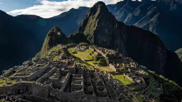
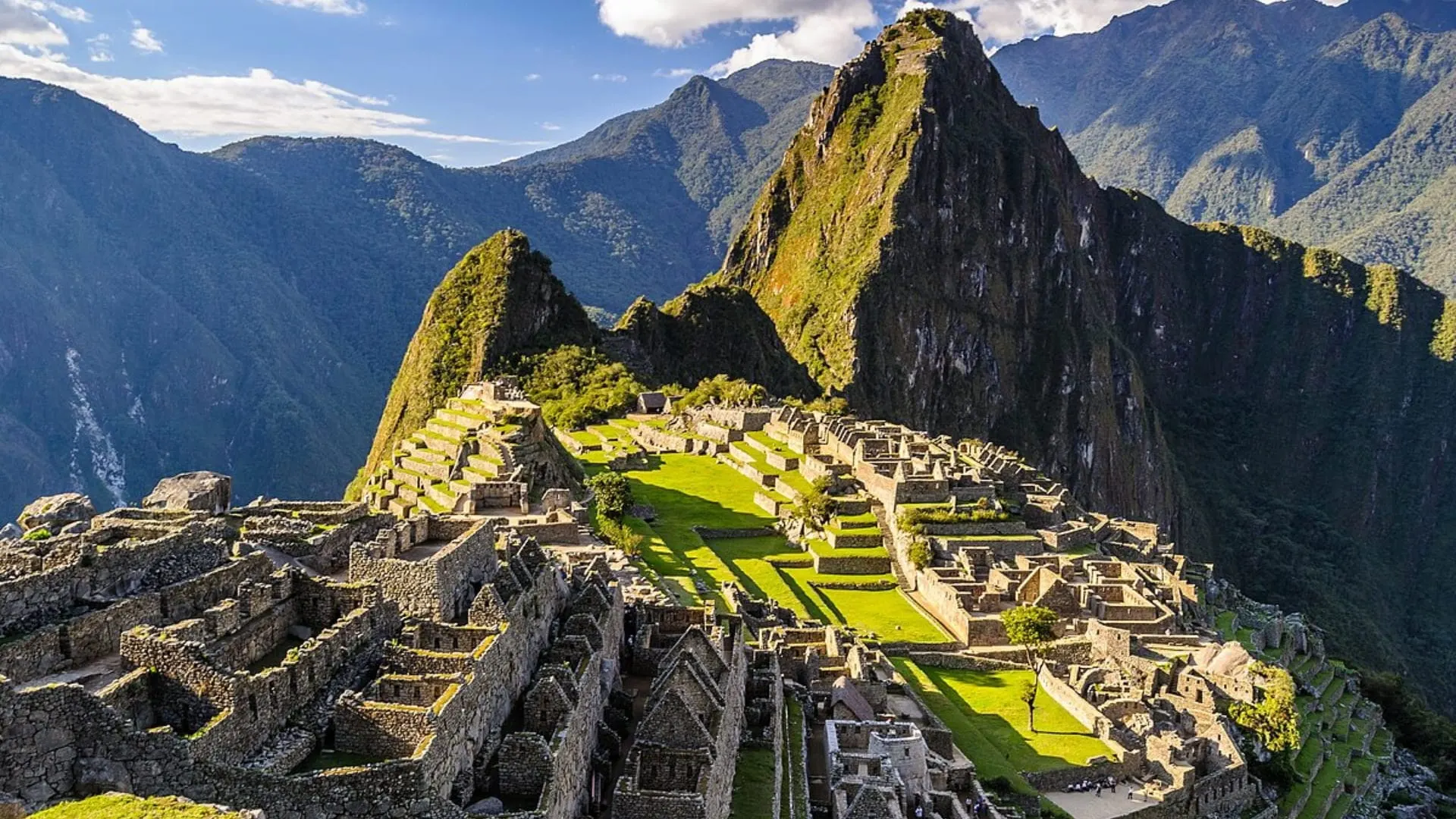
Machu Picchu is a llaqta, a Quechua word for a settlement or town. The Inca state built it on a rocky spur between two peaks: Machu Picchu Mountain to the south and Huayna Picchu, the peak in the classic photo, to the north. Temples, palaces, plazas, houses, water channels and hundreds of terraces follow the shape of the mountain, with walls that seem to grow out of the rock itself. Peru’s Ministry of Culture calls it “the most amazing architectural achievement of the Inca Empire.”
In Quechua, machu means old and picchu means peak or mountain: Machu Picchu is the “old mountain,” and Huayna Picchu, the “young mountain.” The ruins took their name from the taller peak beside them.
Citadel, Ruins or Sanctuary?
You’ll see all three terms, and they don’t mean the same thing:
- Machu Picchu citadel or ruins: the popular name for the archaeological complex, the Inca city you visit with a ticket.
- Llaqta de Machupicchu: the name the Ministry of Culture uses today on its tickets and documents.
- Machupicchu Historic Sanctuary: the 32,592-hectare protected area around the Inca city, with mountains, forests, rivers and the Inca Trail.
Where Is Machu Picchu?
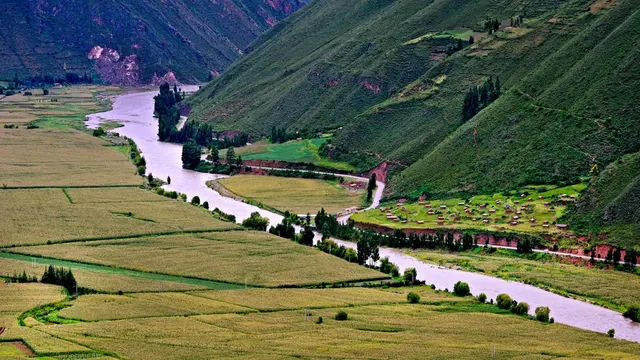
Machu Picchu is in southern Peru, in the Cusco region. It sits on the eastern slope of the Andes, where the mountains start dropping toward the Amazon, in what Peruvians call the ceja de selva (“eyebrow of the jungle”). The landscape is one of sheer, forest-covered mountains, with the Urubamba (or Vilcanota) River looping around the peak.
- From Cusco: about 75 km (47 miles) northwest as the crow flies, based on the coordinates of both places. By the actual access routes the journey is much longer: about 3 h 30 min by train from Poroy station, plus the bus.
- From Aguas Calientes: the Inca city sits about 400 m above the town, roughly 8 km up a winding road.
- From Lima: from the capital you first fly to Cusco, in 1 h 20 min, or travel overland; there is no direct connection to Machu Picchu.
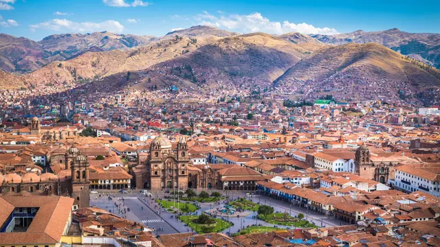
In practice, your base for getting there will be the city of Cusco, the former Inca capital.
Machu Picchu Elevation
The Inca city stands at 2,430 m (7,972 ft) above sea level, the official figure from the Ministry of Culture. That’s almost 1,000 meters lower than Cusco, so breathing is easier than in the city. What wears you out are the stairs and the mountains around it.
| Place | Approximate elevation | What it means for your trip |
|---|---|---|
| Cusco | 3,399 m | The highest point of the classic trip; this is where altitude sickness (soroche) usually hits |
| Ollantaytambo | 2,792 m | Main train station for Machu Picchu |
| Aguas Calientes | 2,040 m | The town at the foot of the citadel; warm, humid weather |
| Machu Picchu (Inca city) | 2,430 m | Stairs and steep sections, but moderate altitude |
| Huayna Picchu | About 2,720 m | Short, very steep climb |
| Machu Picchu Mountain | About 3,082 m | The highest summit you can visit inside the sanctuary |
Elevations for Cusco, Ollantaytambo and Aguas Calientes come from this site’s data; the citadel’s, from the Ministry of Culture; the mountains’, from Inca Rail. Other sources give slightly different figures depending on where the measurement is taken.
Tip: since Machu Picchu is lower than Cusco, many travelers visit the citadel early in their trip and acclimatize in the Sacred Valley. If your ticket includes a mountain, it’s better to climb it after two or three days in the region. You’ll find the guidelines in our guide to altitude sickness in Cusco.
History of Machu Picchu
Who Built Machu Picchu and When
Machu Picchu was a royal estate of the Inca ruler Pachacútec, who turned Cusco into the head of an empire. Colonial chronicles place his rise to power around 1438, and for decades it was thought that the city was built starting in 1440 or 1450. In 2021, a study led by archaeologist Richard Burger of Yale University radiocarbon-dated the remains of 26 people buried at the site and concluded that it was in use from around 1420, some two decades earlier than previously believed.
That study describes it as a country palace for Inca royalty, not a fortress: temples, elite residences, housing for the service staff and a large sector of terraces.
Abandonment
According to the same research, occupation ended around 1530, in the years of the Spanish conquest. Machu Picchu never became a colonial town, and vegetation gradually covered its buildings, though it was never completely forgotten: local farmers knew the place, and some families were farming its terraces in the early 20th century.
Lizárraga, Bingham and the “Discovery”
- 1902: Agustín Lizárraga, a Cusco native, reaches the ruins but fails to get official support to make them known.
- July 24, 1911: Yale professor Hiram Bingham, who was searching for Vilcabamba, the last city of the Incas, climbs up guided by local farmer Melchor Arteaga and accompanied by Sergeant Carrasco. At the site he finds the Recharte and Álvarez families.
- 1912 to 1915: Yale expeditions clear, photograph and excavate the site. In 1913, a feature in National Geographic magazine introduces it to the world.
- 2010 onward: after an agreement between Yale and Peru signed on November 30, 2010, the artifacts and remains Bingham took return to Cusco. Today they are kept at the city’s Machu Picchu Museum.
Was It Really Called Machu Picchu?
It’s not certain. Historian Donato Amado Gonzales, of the Ministry of Culture, and archaeologist Brian Bauer reviewed Bingham’s field notebooks, old maps and land records from several archives, and in the journal Ñawpa Pacha they proposed that the Incas called the site Huayna Picchu, after the nearest summit. An account from the late 16th century already uses that name, and a 1904 atlas places an Inca town called Huayna Picchu there. The name Machu Picchu caught on through Bingham’s publications.
Major Recognitions
- January 8, 1981: the Machupicchu Historic Sanctuary is created as a protected natural area.
- December 9, 1983: UNESCO inscribes it on the World Heritage List as a mixed site, for its cultural and natural value.
- July 7, 2007: it is chosen in Lisbon as one of the New Seven Wonders of the Modern World, after an open online vote. Since then, July 7 has been Machu Picchu Historic Sanctuary Day in Peru.
Machu Picchu Historic Sanctuary
The Machupicchu Historic Sanctuary is much more than the Inca city. It was created by Supreme Decree 001-81-AA of January 8, 1981, covering 32,592 hectares, and SERNANP, Peru’s protected areas service, lists it as a protected natural area. The archaeological park inside it is managed by the Ministry of Culture.
The Urubamba and Vilcabamba mountain ranges run through it, and the Urubamba River cuts it in two, forming the Torontoy canyon. In just a few kilometers it drops from snowcapped peaks over 6,000 m to the riverbank, below 2,000 m. That range explains its biodiversity: the sanctuary has 340 species of orchids and is home to the spectacled bear, the Andean condor, the puma and the otter.
The sanctuary also holds the Inca remains along the Inca Trail, such as Wiñay Wayna and Intipunku, the Sun Gate, through which hikers reach the citadel.
The Ruins of Machu Picchu: What to See
The sanctuary’s master plan, drawn up by Peru’s Ministry of Culture and SERNANP, divides the Inca city into two large sectors separated by a dry moat: the agricultural sector to the south and the urban sector to the north. Together they hold about 216 rooms and enclosures linked by streets, passageways and stairways. The stonework changes with each building’s importance: finely cut walls in the temples and elite residences, and rough masonry in houses and storehouses.
- Agricultural sector: farming terraces spread over two areas, with a group of storehouses (qolqas). The trail from Intipunku comes down through its upper part, and the classic photo is taken from these terraces.
- Upper urban sector: the Temple of the Sun, the House of the Inca, the quarries, the Sacred Plaza and the Intihuatana hill. Travel guides also call it the royal or imperial sector.
- Central plazas: a main plaza and three smaller plazas on different levels, surrounded by terraces, which organize the city along a central axis.
- Lower urban sector: the Sacred Rock, a large ceremonial platform (ushnu) that was never finished, the Three Doorways, more storehouses and the ceremonial and astronomical complex of the Temple of the Condor and the water mirrors.
Here’s a surprising detail: according to the same document, Machu Picchu was never finished. There are half-built structures at the Temple of the Sun, the Sacred Plaza, the Intihuatana and the ushnu, and partly dressed rocks in the quarry area.
The Main Structures of Machu Picchu
- Terraces: they hold up the slope and created flat surfaces for planting. The master plan explains that the city was planned with two goals: stabilizing the ground of granite boulders and building terraces.
- Guardhouse (Casa del Guardián): it stands in the upper part of the Inca city, and the whole site is usually photographed from around it.
- Main gate: the doorway through which the trail down from Intipunku enters the urban sector.
- Dry moat: the trench that separates the agricultural sector from the urban sector.
- Quarries and granite chaos: the outcrop of boulders where the stone was cut. You can still see half-worked blocks and the remains of stonecutters’ workshops.
- Temple of the Sun, or Torreón: a semicircular wall of fine stonework built on a huge boulder, with a channel and four ceremonial fountains beside it, two of them finely carved.
- Royal Tomb: the space beneath the Torreón’s boulder, closed off with fine masonry walls. It is popularly known by that name, and archaeologist Luis Lumbreras suggested it was Pachacútec’s mausoleum, a hypothesis that hasn’t been confirmed.
- House of the Inca: a kancha-type compound, with rooms around a courtyard, next to the Temple of the Sun and the fountains.
- Ceremonial fountains: 16 fountains linked by channels along a stairway that runs through the city from the Temple of the Sun sector.
- Sacred Plaza, Main Temple and Temple of the Three Windows: two buildings of fine stonework that open onto a plaza. Archaeological research detected subsidence in their platform and concluded that both temples were still under construction when the city was abandoned.
- Intihuatana: a finely carved rock, also called sukanka, on top of a terraced hill shaped like a truncated pyramid. The master plan attributes an astronomical and ceremonial role to it.
- Main plaza: the large open space that separates the upper and lower urban sectors.
- Sacred Rock: a large boulder with a carved base, flanked by two open-fronted buildings. The trail to Huayna Picchu starts here.
- Three Doorways and Twelve Openings: this sector brings together three housing compounds with double-jamb doorways, a building with twelve openings and six storehouses, or qolqas, on terraces.
- Temple of the Condor: two large rocks that look like a condor’s wings, with the head carved into the ground and an underground cave.
- Water mirrors: two circular sculptures carved into the rock at ground level, inside the ceremonial and astronomical complex.
What many travelers don’t know is that you can’t see everything with a single ticket. Since June 1, 2024, visits follow 3 circuits and 10 one-way routes, and each ticket opens only one of them:
| Circuit | What it covers | Best for |
|---|---|---|
| 1 Panoramic | Upper terraces, views from above and routes to Machu Picchu Mountain, Intipunku and the Inca Bridge | Travelers after the photo from above or a hike |
| 2 Classic | Agricultural sector and most of the urban sector | A first visit, with a guide |
| 3 Royalty | Royal sector and routes to Huayna Picchu, the Great Cavern and Huchuy Picchu | Temples of the Inca elite, short visits or a mountain |
The exact path of each circuit, its distance and its maximum visiting time are in Machu Picchu circuits: all 10 routes explained.
Where to Take the Classic Machu Picchu Photo
The best-known pictures of Machu Picchu are taken from the upper terraces of the agricultural sector, with the city below and Huayna Picchu behind it. Route 1-B (Upper Terrace) leads to the highest viewpoint; Routes 2-A and 3-B also pass a classic photo spot. For your Machu Picchu photos, keep in mind that drones, tripods and camera or phone mounts are banned inside the sanctuary.
What You See on Each Circuit
The Ministry of Culture publishes an official map of each route with 14 numbered reference points, and in July 2024 it added an infographic that marks, for Routes 2-A, 2-B and 3-B, which points you can access and which you can’t. The table sums up what those documents show. All 10 routes are still in force: Ministerial Resolution 000334-2026-MC, published on September 11, 2026, keeps them under the same names.
Machu Picchu: what you see on each route
| 1-A | 1-B | 1-C | 1-D | 2-A | 2-B | 3-A | 3-B | 3-C | 3-D | |
|---|---|---|---|---|---|---|---|---|---|---|
| Upper Platform | ✓ | ✓ | ✓ | ✓ | ||||||
| Lower Platform | ✓ | |||||||||
| Dry Moat | ✓ | ✓ | ||||||||
| Temple of the Sun Viewpoint | ✓ | ✓ | ||||||||
| Granite Chaos | ✓ | ✓ | ||||||||
| Plaza of the TemplesMain Temple and Three Windows | ✓ | ✓ | ||||||||
| Main Plaza | ✓ | ✓ | ||||||||
| Sacred Rock | ✓ | ✓ | ✓ | ✓ | ✓ | |||||
| Twelve Openings | ✓ | ✓ | ✓ | ✓ | ✓ | ✓ | ||||
| Eastern Qolqas | ✓ | ✓ | ✓ | ✓ | ✓ | ✓ | ||||
| Water Mirrors | ✓ | ✓ | ||||||||
| Temple of the Condor | ✓ | ✓ | ✓ | ✓ | ||||||
| Pisonay Plaza | ✓ | ✓ | ✓ | ✓ | ✓ | ✓ | ||||
| Intihuatanano access on the 2024 maps |
- The route passes this point
| Structure | Routes that include it |
|---|---|
| Upper Platform (upper terraces) | 1-A, 1-B, 1-C, 1-D |
| Lower Platform (lower terraces) | 2-B |
| Dry Moat | 2-A, 2-B |
| Temple of the Sun Viewpoint, in the quarry area | 2-A, 2-B |
| Granite Chaos | 2-A, 2-B |
| Plaza of the Temples (Main Temple and Three Windows) | 2-A, 2-B |
| Main Plaza | 2-A, 2-B |
| Sacred Rock | 2-A, 2-B, 3-A, 3-C, 3-D |
| Twelve Openings | 2-A, 2-B, 3-A, 3-B, 3-C, 3-D |
| Eastern Qolqas | 2-A, 2-B, 3-A, 3-B, 3-C, 3-D |
| Pisonay Plaza | 2-A, 2-B, 3-A, 3-B, 3-C, 3-D |
| Water Mirrors | 2-A, 2-B |
| Temple of the Condor | 3-A, 3-B, 3-C, 3-D |
| Temple of the Sun and House of the Inca area | Circuit 3, according to its official description |
| Intihuatana | None: marked as closed to visitors |
Sources: official route maps (May and June 2024), the circuit equivalence infographic (July 2024) and the circuit descriptions on the Tu Boleto portal. For Routes 3-A, 3-C and 3-D, the table follows the line on each map, which inside the city repeats the 3-B path and continues to the Sacred Rock, where the trail to the mountains begins.
Circuit 1: The City from Above
Its four routes climb the terraces of the agricultural sector to the Upper Platform, the viewpoint for the classic photo, and don’t enter the urban sector. Route 1-B ends there; 1-A continues to the summit of Machu Picchu Mountain, 1-C to Intipunku and 1-D to the viewpoint over the Inca Bridge.
Circuit 2: The One That Covers the Most of the City
Route 2-A crosses the dry moat and passes the quarries and the Temple of the Sun viewpoint, the Plaza of the Temples, the main plaza, the Sacred Rock, the Twelve Openings, the qolqas, the water mirrors and Pisonay Plaza. Route 2-B does the same and adds the Lower Platform. Neither one enters the Temple of the Condor or the Intihuatana, and you see the Temple of the Sun from the viewpoint.
Circuit 3: The Royal Sector and the Mountains
Route 3-B is the shortest: according to the official infographic, it gives access to the Twelve Openings, the eastern qolqas, the Temple of the Condor and Pisonay Plaza. Tu Boleto adds that the circuit lets you see the Temple of the Sun and the House of the Inca, and the same infographic mentions the sacred fountains and the terraces. It doesn’t pass the Sacred Rock, the Plaza of the Temples, the quarries or the water mirrors. Routes 3-A, 3-C and 3-D cover the same area and carry on past the Sacred Rock toward Huayna Picchu, the Great Cavern or Huchuy Picchu.
Which Circuit Shows the Most of the Citadel?
Circuit 2. According to the official infographic, Route 2-B passes 10 of the 14 points on the map and Route 2-A passes 9, compared with 4 on Route 3-B. To see nearly everything you need two tickets: one route on Circuit 2 and another on Circuit 3. Even then, two points can’t be visited on any route: the Intihuatana and the so-called archaeological reserve, a sector set aside for future research.
Are the Intihuatana, the Temple of the Sun and the Temple of the Condor Closed?
In September 2023, the Cusco office of the Ministry of Culture announced that these three spaces would close temporarily to visitors because of wear on the stone of their paths and stairways, without setting a date. Here is what the official documents show today:
- Intihuatana: on the 2024 maps and infographic it is marked as closed on every route. We haven’t found any official reopening announcement in 2025 or 2026 (last checked in October 2026).
- Temple of the Sun: Circuit 2 sees it from a viewpoint, and Tu Boleto includes it in the description of Circuit 3.
- Temple of the Condor: it is shown as accessible on Route 3-B in the 2024 infographic and in the description of Circuit 3.
These restrictions can change for conservation reasons. Before you buy, open the map of the route you’re interested in on Tu Boleto and compare distances and effort in our guide to Machu Picchu circuits.
The Mountains of Machu Picchu
Three summits can be climbed with a special ticket, which already includes entry to the Inca city:
- Huayna Picchu (Route 3-A): the postcard peak, with a short, very steep climb and exposed sections. It’s the ticket that sells out first.
- Machu Picchu Mountain (Route 1-A): higher and longer, with wide stone staircases and the broadest panorama, with snowcapped peaks in the background.
- Huchuy Picchu (Route 3-D): a low summit with moderate effort, available only in peak season.
If you can’t decide between the two big ones, compare distance, exposure and views in Huayna Picchu vs. Machu Picchu Mountain: which to choose.
How to Get to Machu Picchu
There is no direct road from Cusco. Every option ends in Aguas Calientes, and from there you go up to the citadel by bus, in 25 to 30 minutes, or on foot, in about an hour and a half. In short:
- By train: PeruRail and Inca Rail run mostly from Ollantaytambo, in the Sacred Valley, with rides of 1 h 30 min to 2 h. PeruRail also has a direct train from Poroy, near Cusco, from May to December. The panoramic trains have skylight windows. Classes and schedules in our guide to the train to Machu Picchu.
- Via Hidroeléctrica: a drive to the hydroelectric plant and a walk of about 2 h 30 min along the railroad tracks. It’s the budget option. Details in the Hidroeléctrica route.
- On foot: the Inca Trail, with limited permits, or treks such as the Salkantay.
- Last stretch: the Consettur bus runs up from 5:30 a.m. to 3:30 p.m.; the reference fare for foreign adults is US$24 round trip. More in our guide to the bus to Machu Picchu.
We compare every option, with travel times and who each one suits, in how to get to Machu Picchu from Cusco.
Machu Picchu Entrance Tickets
Entry is bought for a specific date, entry time and route on Tu Boleto, the Ministry of Culture’s official platform. Entry slots run from 6:00 a.m. to 3:00 p.m., one per hour, with a 30-minute grace period at the main gate, or 45 minutes in the busiest months. Tickets are issued in your name: at the gate they check your original passport or ID.
Daily capacity is limited (5,600 people on the busiest dates of 2026 and 4,500 the rest of the year, with a separate quota for each circuit, route and time slot), so the ticket is the first thing to sell out and the first thing you should buy, before the train and the hotel. The portal shows the exact price for your category and route; routes with a mountain cost more. We walk you through it step by step in our guide to Machu Picchu tickets, with fares by traveler type in Machu Picchu ticket types.
Important: the only official sales website is tuboleto.cultura.pe. Be wary of sites with similar names and of anyone offering dates the portal shows as sold out: tickets bearing someone else’s details are caught at the gate.
Weather and the Best Time to Visit Machu Picchu
Machu Picchu has a cloud-forest climate: warmer and more humid than Cusco, with misty mornings that usually clear as the day goes on. It can rain in any month, and much more from November to March.
- Dry season (May to September): more clear days and more visitors. Buy your ticket one to three months in advance.
- April, May, September and October: the best balance between weather and crowds.
- Rainy season (November to March): very green scenery and fewer people, with showers almost every day. Machu Picchu is open all year; what closes every February is the Inca Trail.
The month-by-month details, with temperatures and rainfall, are in Cusco weather by month.
Machu Picchu Town: Aguas Calientes
When people talk about Machu Picchu town, they mean Aguas Calientes, whose official name is Machupicchu Pueblo. It sits at 2,040 m, on the valley floor, and it’s where the trains arrive and the buses leave for the citadel. It has hotels, restaurants, hot springs and a ticket office that sells in-person tickets for the following day.
How Many Days Do You Need for Machu Picchu?
- As a day trip from Cusco: it’s possible, but it takes about 16 hours between transfers, train, bus and the visit. It works if you only want one circuit without a mountain.
- Two days, with a night in Aguas Calientes: the option we recommend most. You enter on an early slot, with fewer people and better light, and you can add a mountain or a second circuit.
- As part of a trip around the region: with four or five days you can see Cusco, the Sacred Valley and Machu Picchu. You’ll find suggestions in our 3-, 5- and 7-day Cusco itinerary.
Tip: if you want to see the Inca city at a relaxed pace, buy two tickets for two different routes, for example a mountain one day and Circuit 2 the next. Each ticket is valid for a single route and doesn’t let you double back.
Tips for Visiting Machu Picchu
- Bring the original ID you registered when you bought your ticket: they ask for it on the bus and at the gate. Copies and photos aren’t accepted.
- Small backpack: no larger than 40 × 35 × 20 cm.
- Leave banned items behind: food, trekking poles, umbrellas, tripods, drones, aerosols and hard-soled shoes, among other things. Check the full list in what not to bring to Machu Picchu.
- Bring water, sunscreen, insect repellent and a rain jacket: in a single day you can get strong sun, mosquitoes and rain.
- Consider an official tour guide: it isn’t mandatory. The current rules, amended by Ministerial Resolution 000334-2026-MC, recommend going with a guide to protect the site and keep visits orderly, and only require your ticket and ID. There are almost no signs inside, and a good guide explains each sector within the time your route allows.
- Stick to the route: don’t climb on the walls; breaking the rules can get you removed without a refund.
Bottom Line: Where to Start
- Choose your date and route and buy the ticket on the official portal. On a first visit, Circuit 2 covers the most of the city. If you want a mountain, decide between Huayna Picchu and Machu Picchu Mountain before you pay.
- Book the train so you reach Aguas Calientes at least an hour before your entry time.
- Book a night in Aguas Calientes if you’re entering on one of the first slots or climbing a mountain.
- Buy the bus ticket and schedule your acclimatization days in Cusco and the Sacred Valley before the visit.
Frequently asked questions
Where is Machu Picchu located?
In southern Peru, in the Cusco region, Urubamba province and Machupicchu district. It sits above the Urubamba River canyon, about 75 km (47 miles) northwest of the city of Cusco as the crow flies.
What is the elevation of Machu Picchu?
The Inca city stands at 2,430 meters (7,972 feet) above sea level, according to Peru’s Ministry of Culture. Aguas Calientes, the town below, is at about 2,040 m, and Cusco at about 3,399 m.
What is Machu Picchu and why is it so famous?
It’s an Inca city built on a mountain, with temples, palaces and terraces blended into the landscape. Its architecture, its state of preservation and its setting of forest and snowcapped peaks made it a World Heritage Site and a wonder of the modern world.
Who built Machu Picchu?
The Incas, as a royal estate for Pachacútec. A radiocarbon study published in 2021 shows the site was already in use around 1420.
Who discovered Machu Picchu?
Local farmers always knew about it. Agustín Lizárraga, from Cusco, reached it in 1902, and Hiram Bingham of Yale University made it known to the world after his visit on July 24, 1911.
What is the Machu Picchu Historic Sanctuary?
It’s the 32,592-hectare protected natural area created on January 8, 1981, around the Inca city. It includes mountains, forests, the Urubamba River and the Inca Trail.
Is Machu Picchu one of the Seven Wonders of the World?
Yes. It was chosen as one of the New Seven Wonders of the Modern World on July 7, 2007, in Lisbon, after an online vote.
When is the best time to visit Machu Picchu?
April, May, September and October offer the best balance between weather and crowds. From May to September there is more sun and more people, and from November to March it rains often, although the sanctuary is open all year.
How many people can enter Machu Picchu per day?
In 2026, capacity is 5,600 visitors a day on January 1, April 2 to 5, June 19 to November 2 and December 30 and 31, and 4,500 the rest of the year. Each circuit, route and time slot also has its own quota.
Do you need a guide to visit Machu Picchu?
No. The current rules, amended by Ministerial Resolution 000334-2026-MC in September 2026, recommend going with a tour guide, but only require your ticket and original ID.
How long does a visit to Machu Picchu take?
It depends on the route. The maximum time is 2 hours 30 minutes on Routes 1-B, 2-A, 2-B and 3-B; 3 hours on 1-D; 3 hours 30 minutes on 3-D; 4 hours on 1-C; 6 hours on 3-A; and 7 hours on 1-A and 3-C. Add about 30 minutes by bus each way.
Which circuit shows the most of the citadel?
Circuit 2. According to the official infographic, Route 2-B passes 10 of the 14 points on the map and Route 2-A passes 9, including the Plaza of the Temples, the Sacred Rock and the water mirrors. The Temple of the Condor is only on Circuit 3.
Official sources
- Ministry of Culture: entry times and grace periods machupicchu.gob.pe · PDF · Download the original PDF
- Ministry of Culture: rules of conduct at Machupicchu machupicchu.gob.pe
- Yale News: Machu Picchu is older than expected (2021) news.yale.edu
- Inca Rail: comparison of the Machu Picchu mountains (elevations) blog.incarail.com

How we put this guide together
Written by Paul Pumalloclla · 17 years in tourism
- Official sources Prices, opening hours and rules checked against Peru’s Ministry of Culture, SERNANP, PromPerú and the train and bus operators.
- Sources cited Every guide links to the sources we used at the end.
- Always up to date When a rule changes, we update the guide and its date.
We’re not a travel agency: we don’t sell tours or take bookings. If a link belongs to a commercial partner, we label it next to the link, and that never changes the facts or the recommendations.
Guide history
- Published
- Last reviewed
Spotted something out of date?
Let us know and we’ll check it against the official source.
Report a change